

The Tracy water tower in the center of town was still visible and football is still king as you look at the field and the seating but Tracy now has three high schools so Tracy High is not the only school the town cheers for anymore.


After seeing the school we went to find the home that Cindy grew up in. She was a little nervous because she did not know what shape it would be in. It turned out to be fine.

From there we went to the church that the family spent years helping build with fund raisers and meant so much to them.

We drove by the senior elementary that she was bussed to to go to school and had such bad experiences but now it seems to be a nice area.


It was late afternoon so we decided to go to the tunnel view area to look at the valley. From there you could see El Capitan and Bridalveil Falls and the entrance into the valley and Half Dome in the distance.


We then went to Bridalveil falls. The breeze whips the waterfall into wisps and at this time of day rainbows are found all over the falls.

We parked the car and walked closer to the falls.


We went over the Yosemite Village but everything was closed up and it was getting dark. We had a view of half dome from there though. We had to drive outside of the park a got some pizza at a hotel area and then had a two hour drive back to our hotel.

The next morning we thought we would take a different route to Yosemite to see if it was any quicker and also to see more of the countryside. We went north to highway 132 and then east along 132. The scenes changed from almond orchards to rolling hills and pasture and stately oak trees.

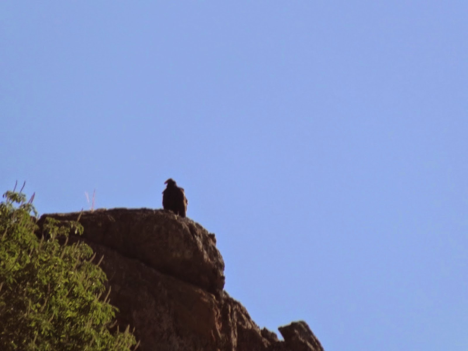
We then came into the foothills of the Sierra's. There we looked down into an empty reservoir. California is in the 4th year of a drought and they only had 13% of snowfall in the mountains this year. We looked the other way and so condors flying above the cliffs where we had parked .


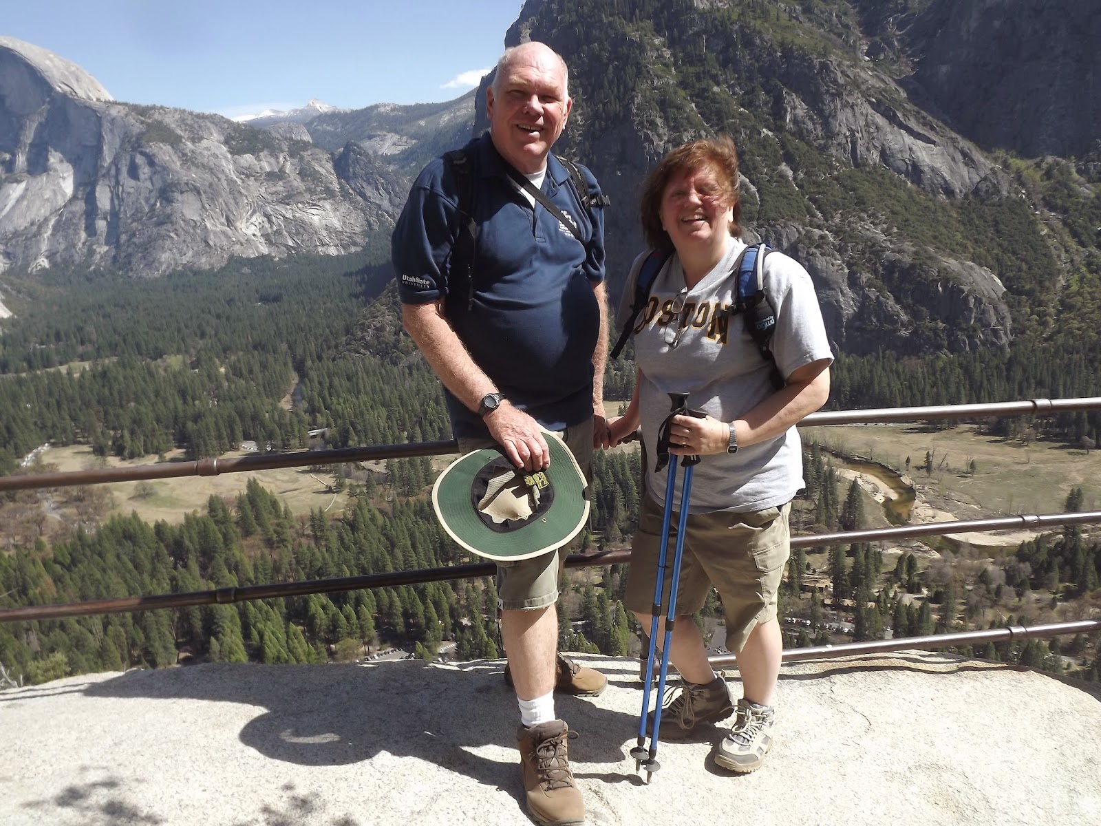
We continued on winding up the hills to get to the main road and came into the park at the Big Oak Flat entrance this time. It was still a two hour drive but beautiful country. As you drive along this road you are above Yosemite Valley and come across some great views of Half Dome. (Yes that is both my bald head and the mountain.)


As you descend to the valley floor there are waterfalls that you pass by.


We made it to the valley floor and then parked and went to the village to have lunch. From this area you could see Upper and Lower Yosemite Falls. We thought this was crowded as there were cars parked everywhere but a local who comes here often thought this was a light day for the number of people here.

After lunch we decided to do the upper Yosemite Falls trail to Columbia rock. It is a 1,000 foot vertical climb in a couple of miles and is mostly rock stairs but there were tremendous views all along the way.


It was a little breezy at the point as there was many hats on the cliffs below the railing. We decided to go further up the trail so we could have a good view of the upper falls from its base. It was well worth the extra distance.


We then turned around and made our way back. It is interesting the different views you have going down that you do not see when you are going up.


We then decided to drive to Glacier Point which is normally still closed because of snow this time of year but not this time. While it was pleasant in the valley in the mid 60's it was getting cold at Glacier Point with the wind and the temperature being in the 40's but the views were great. People were waiting for the sunset to get pictures of half dome but we were not going to wait that long. There were great views and you could see Vernal and Nevada Falls from this point. After this it was back to Turlock and our Yosemite visit was over. It was well worth it.


No comments:
Post a Comment